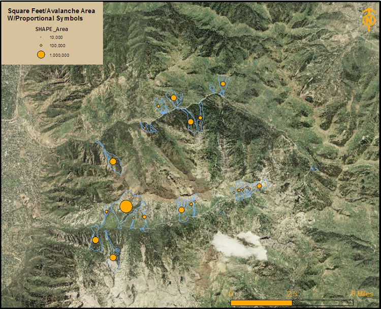
Mapping Utah Avalanches
The following was mapped using proportional symbols to reflect square feet per area of each path. It becomes easier to see where the larger slides are occuring. This map also excluded slide frequency intervals of less than frequent.